August 14, 2021 Greenwood and Dumbbell
After the recent trip to the Twin Sisters to climb the South Twin Sister, we discussed other options for an overnight trip during August.
Brandon, Liz, and I all were available August 14-15 for an overnight, so we made some tentative plans to climb something cool then.
Possible options were:
- Three Fingers
- Tomyhoi
- Greenwood & Dumbbell
As the days approached, wildfire smoke started to filter into western Washington, mostly from California. The weather and smoke forecasts indicated that a marine push would begin to push the smoke eastwards Friday and Saturday, with the clearest views on Sunday.
We ended up settling on Greenwood & Dumbbell as we felt they were close enough to the crest to be cleared out by the incoming marine push, and we weren’t really too interested in staying in the Three Fingers lookout with a bunch of other people.
Some people climb these two in a 12-hour car-to-car push, but we decided to camp high and climb them as an overnight. We had read other trip reports of camping in the Phelps basin around 5500’, and some other spots between 6500’-7000’ higher up.
Saturday morning we met up at Cole’s Corner at 7:30, and drove the Chiwawa River Road to Phelps Creek turnoff. I was concerned that my car might not make it all the way (Ford Focus), so opted to leave my car below the turnoff and hopped in Brandon’s Jeep for the final few miles to Phelps Creek Trailhead. However, we did see a Honda Civic at the trailhead so it may be possible (although ill-advised) for lower-clearance cars.
Arriving at the trailhead, it was pretty smokey, and visibility was probably less than 5 miles. Around 9:15, we started hiking in along the flat Phelps Creek trail for 5.5 miles until we entered Spider Gap Meadows 2 hours later.
 Spider Gap Meadows
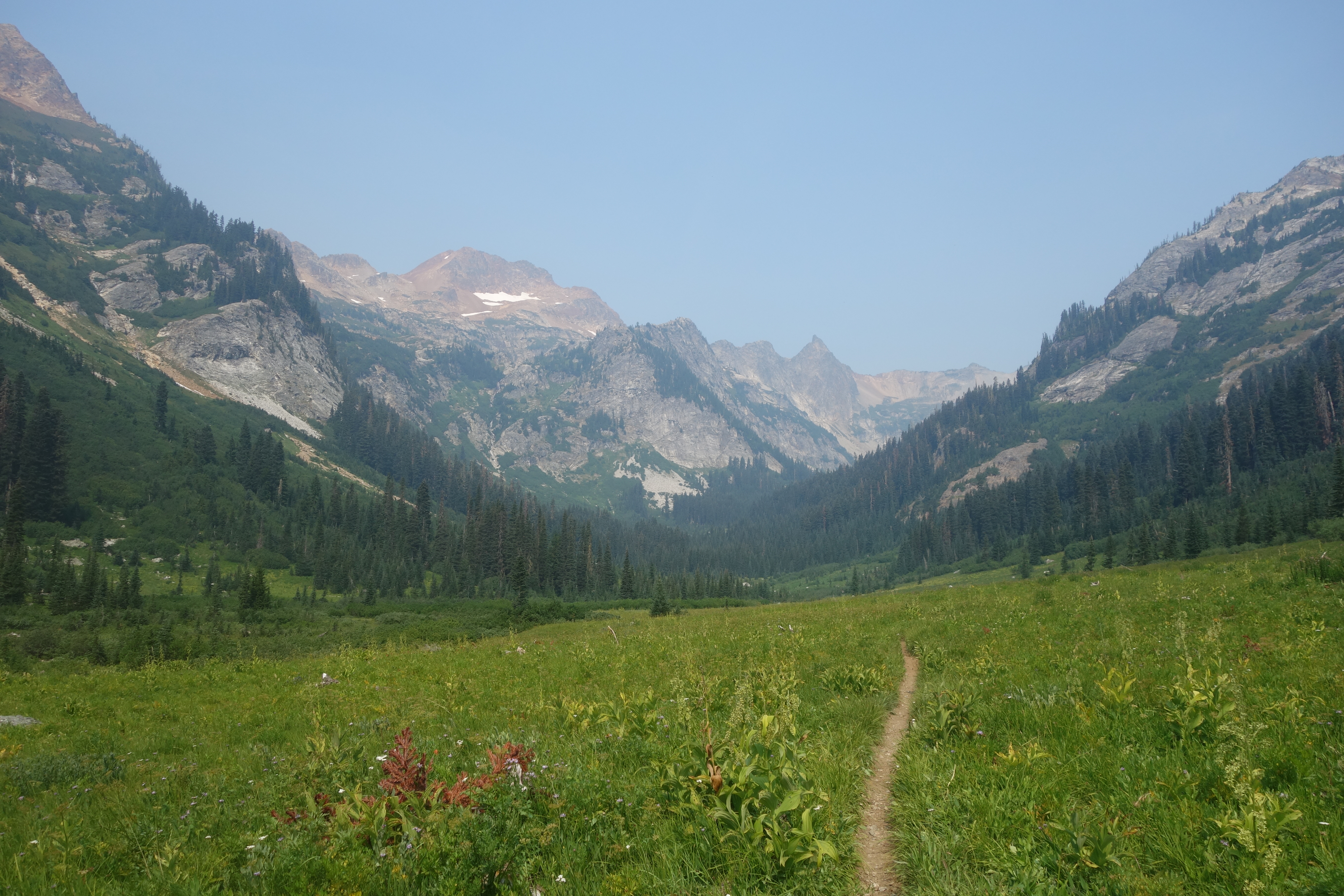
Continuing through the Meadows, we followed the trail to where it splits. Left to Spider Gap, right into Phelps Basin which we took.
 Phelps Basin opening up
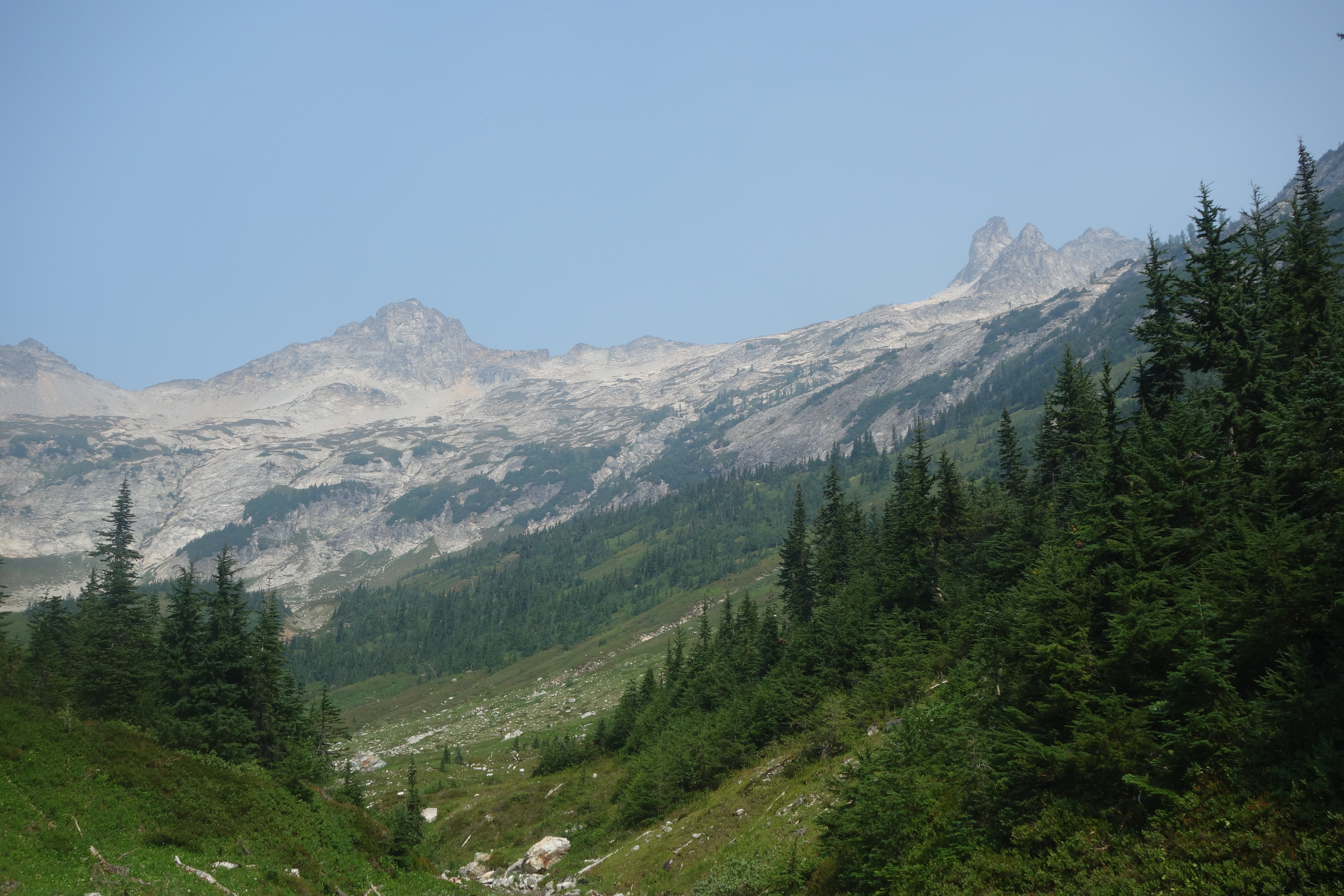
Fairly quickly in Phelps Basin, the terrain opened up and became a big broad basin, and the trail sort-of petered out. We walked up into the basin to the first option of camping, 5500’. Since it was only 12:30, we opted to continue higher to look for the high camp.
There is a climbers trail to follow up through the basin and next to the waterfalls that you hike through. We followed this up, and eventually crossed the creek around 6500’, finding a flatish spot around 6700’. We looked around for some other camp spots, but didn’t see anything better, so set up camp.
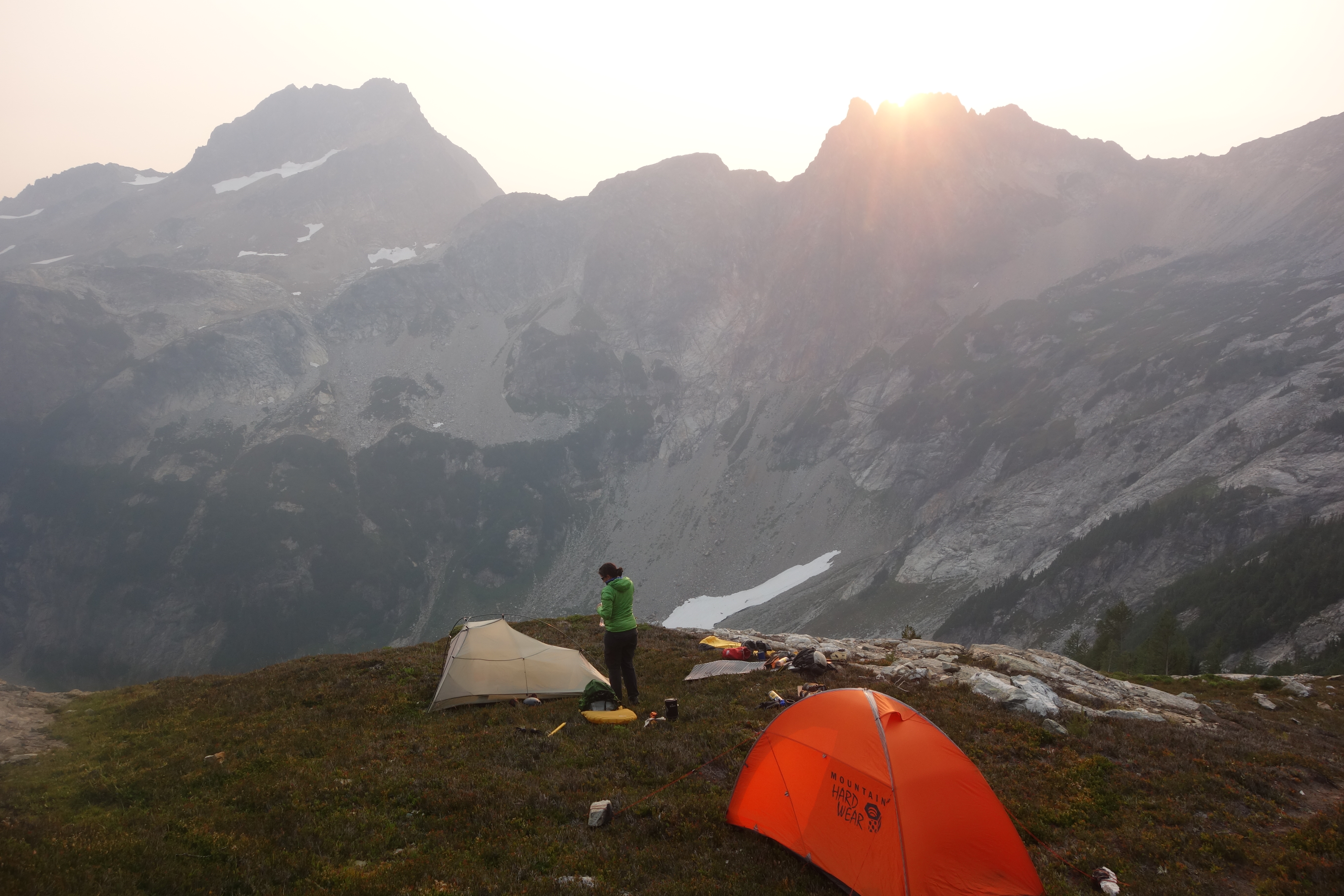 Camping around 6700’
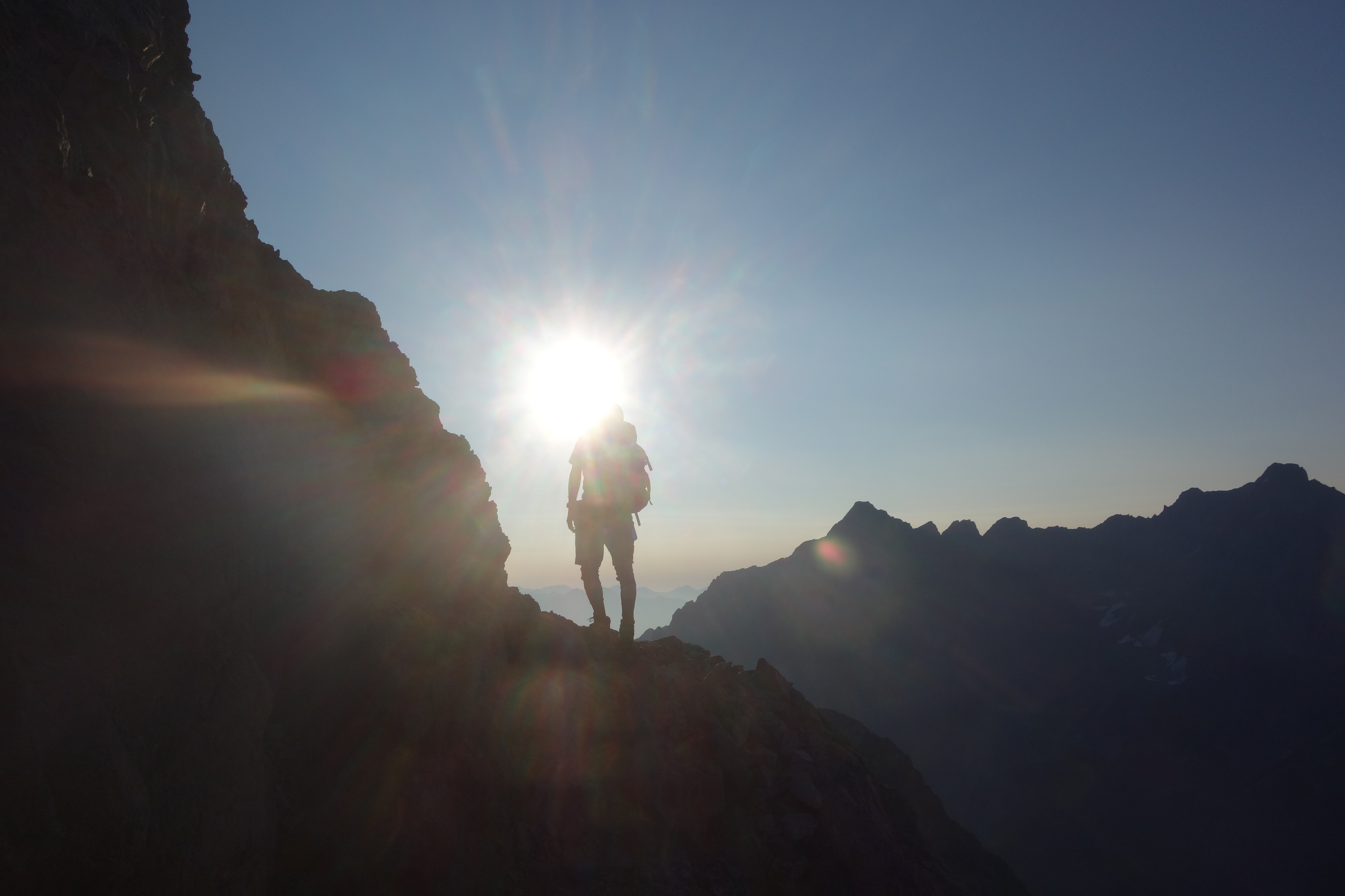
At this point it was obvious that the smoke wasn’t going away today, so we decided to go for the summit Sunday, and hope that it would clear overnight. It was still early, and I didn’t feel too interested in just sitting around at camp doing nothing, so decided to hike up to the Phelps Ridge and see if I could get to the top of a small high point on the ridge.
Nobody else was interested, but it looked straight forward enough, so I hiked roughly 1mi. across the heather and talus slopes, ascended more talus to the ridge, where I was greeted with some moderate winds and a hazy view of Bonanza.
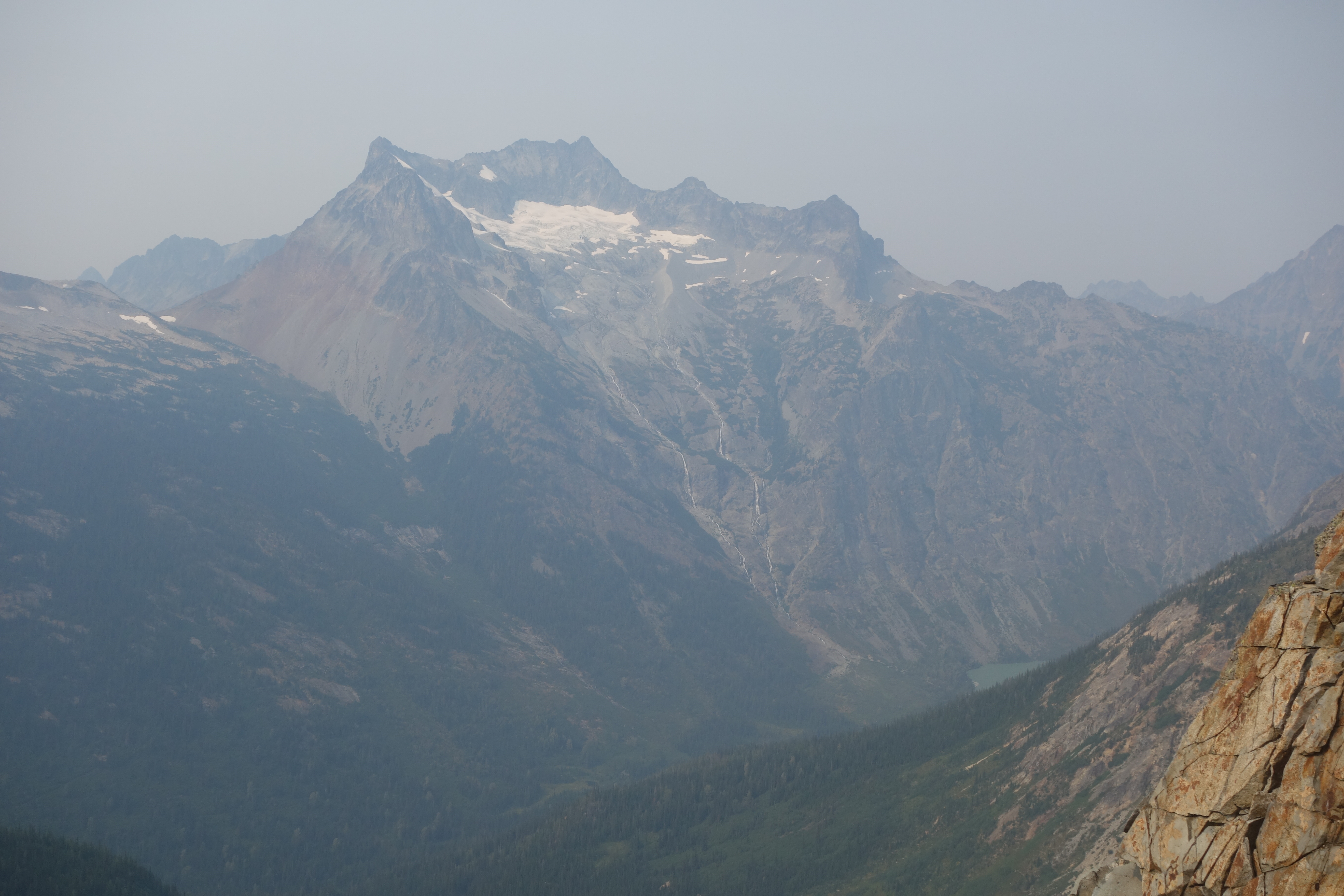 Hazy Bonanza
I scrambled to the top of the high point, which was actually more involved than expected, and then came back down and hiked back to camp. By the time I got back it was time for dinner and we hung out until 8:30pm when we went to bed.
Sunday we woke up at 5am and headed out at 6 for the summits. The wind seemed to have cleared out most of the smoke overnight, so we were happy with our decision to postpone the summits until Sunday.
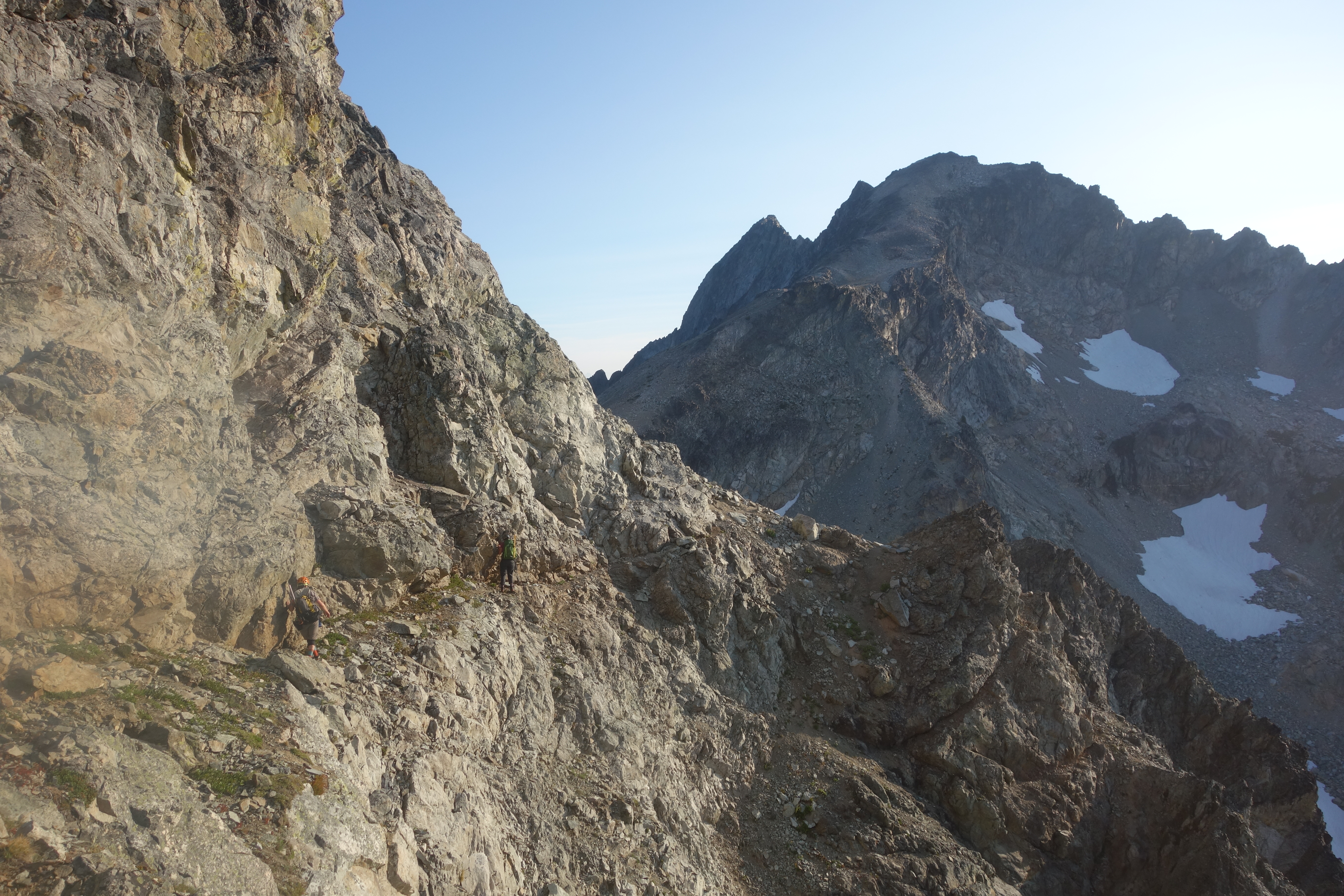
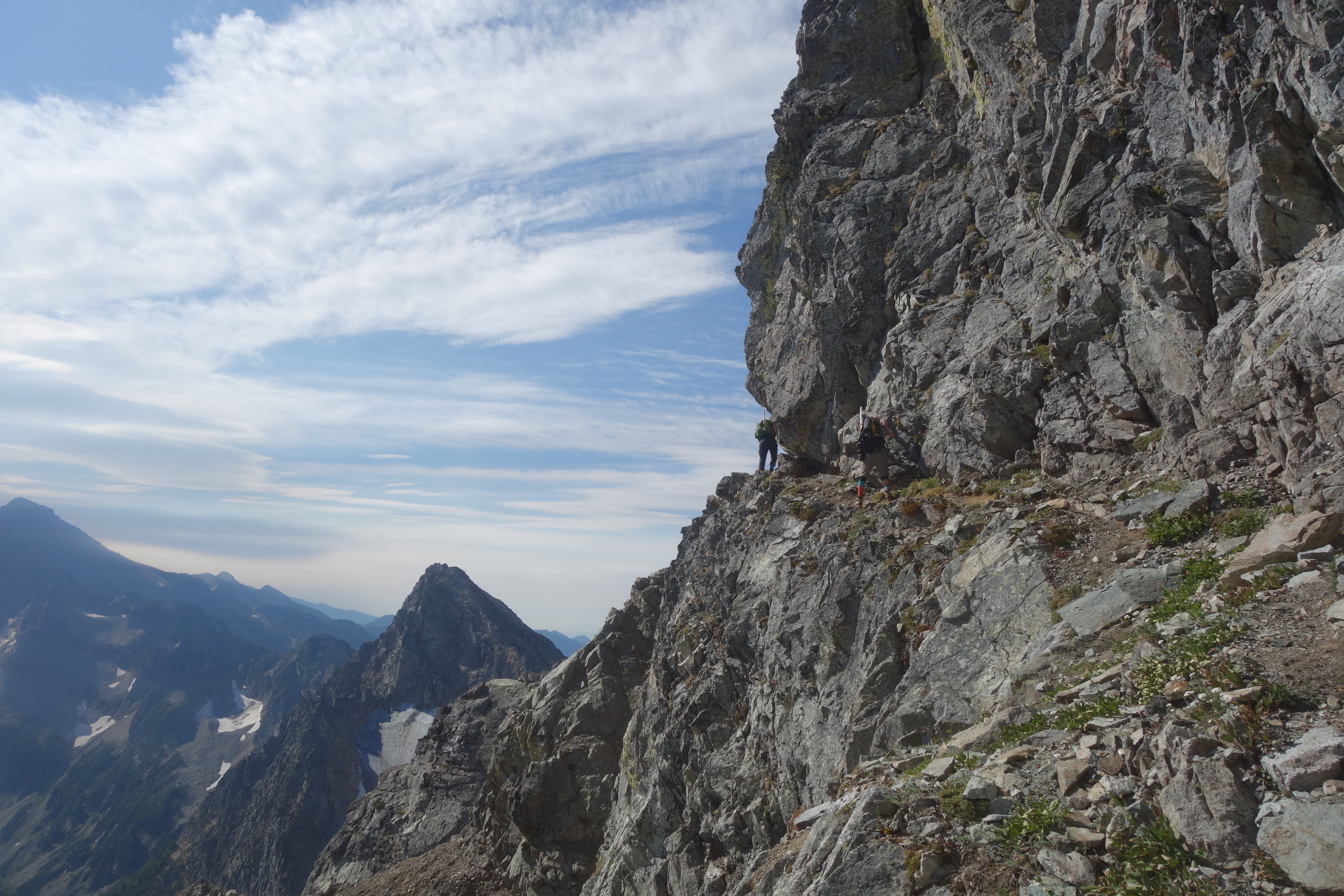
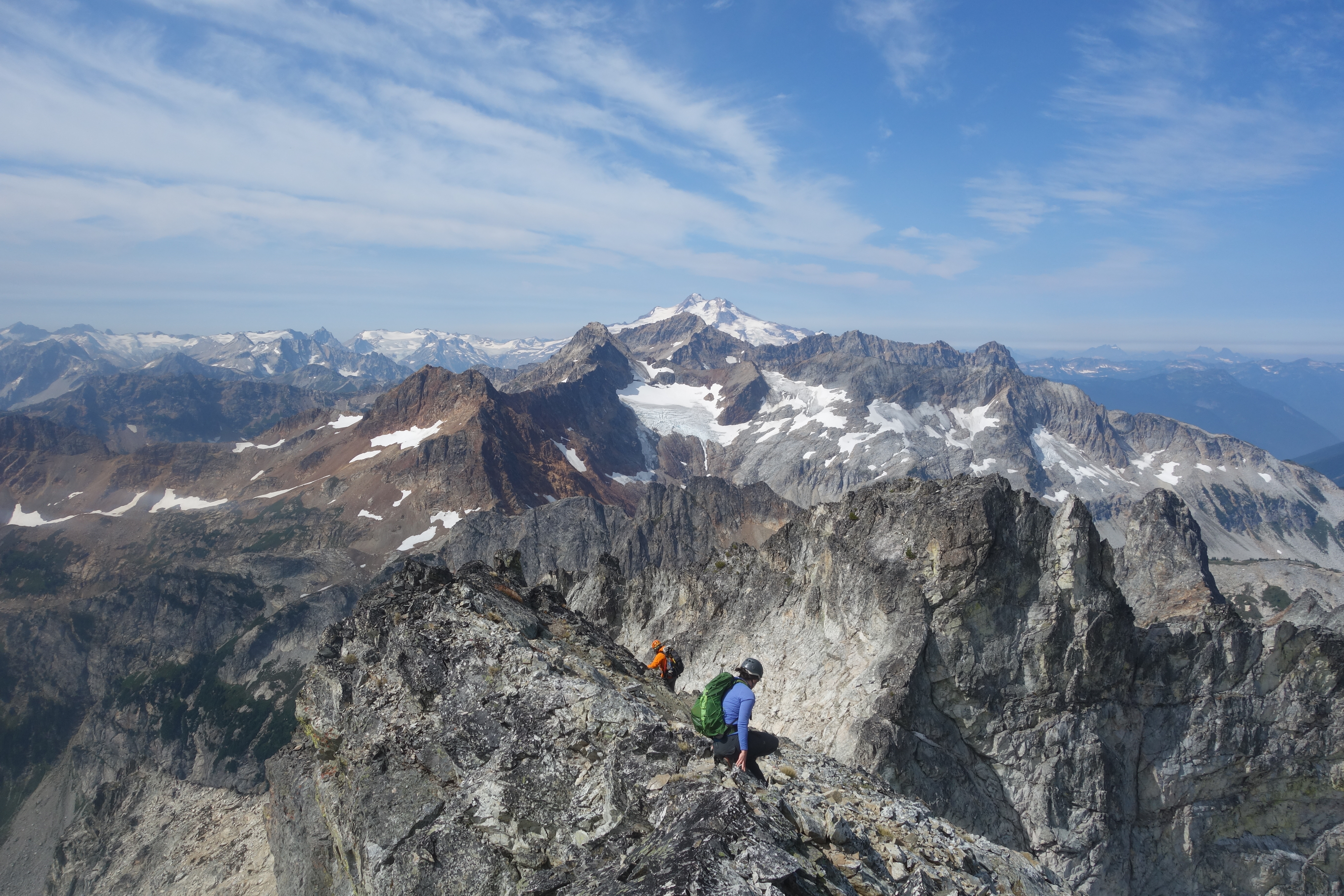
Our first target was Greenwood, which is farther away. We ascended through talus fields to the notch in the ridge at 7900’ to find the ‘Baby Carriage Ledge’. We’d heard a lot about this ledge that’s about a foot wide in places, with some decent exposure, but it didn’t seem too bad. The worst part of it was at the beginning trying to get down a 5-foot section of exposed dirt slanting away from you. Soon enough, all three of us were through the ledge and headed toward Greenwood.
 Backlit on the ledge
 Ledge
Ledge
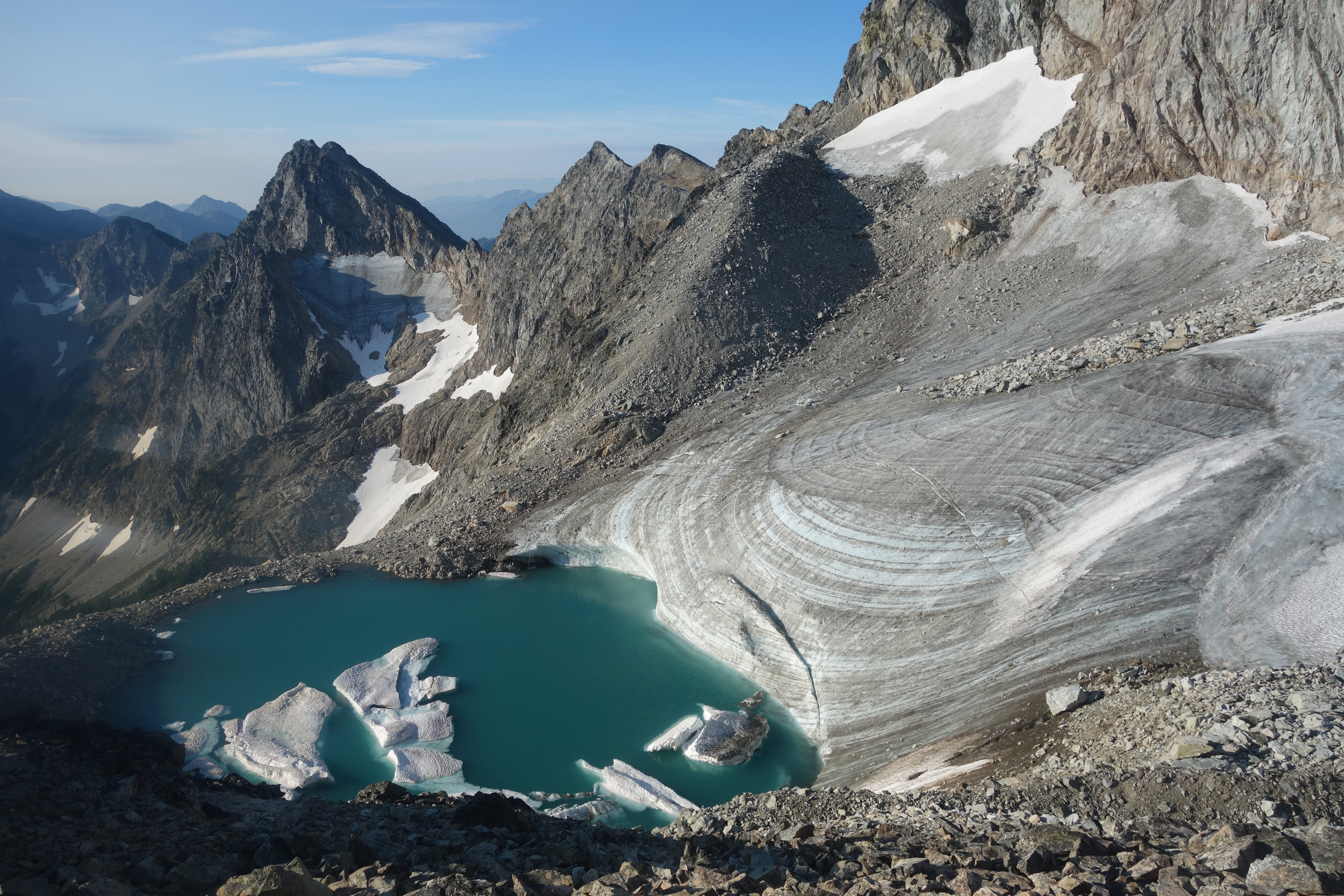
We threw on some crampons to cross a snow field / ice sheet above a fairly large tarn. It looked like it would be a pretty fun slip-n-slide if you didn’t mind the freezing water at the bottom! The rest of Greenwood was a class 2 walkup for the last 700’ or so and we were soon at the top.
 Tarn between Greenwood & Dumbbell
From Greenwood you could see the village of Holden, mountains Bonanza, Eldorado, Dome, Baker & Shuksan looking small and out of place, and some of the closer peaks in the Glacier Peak wilderness, Fortress, Chiwawa, Buck, Berge, Copper, Fernow, 7FJ, Maude, among others. You could also see down to the Stuart range, and I’m pretty sure that I could see Rainier peaking out behind Buck, but couldn’t be positive it wasn’t a cloud.
The summit register was placed in someone’s Nalgene a couple years ago, and it was difficult to get out. Liz donated a hair band to the cause, so maybe future peakbaggers won’t struggle as much with it.
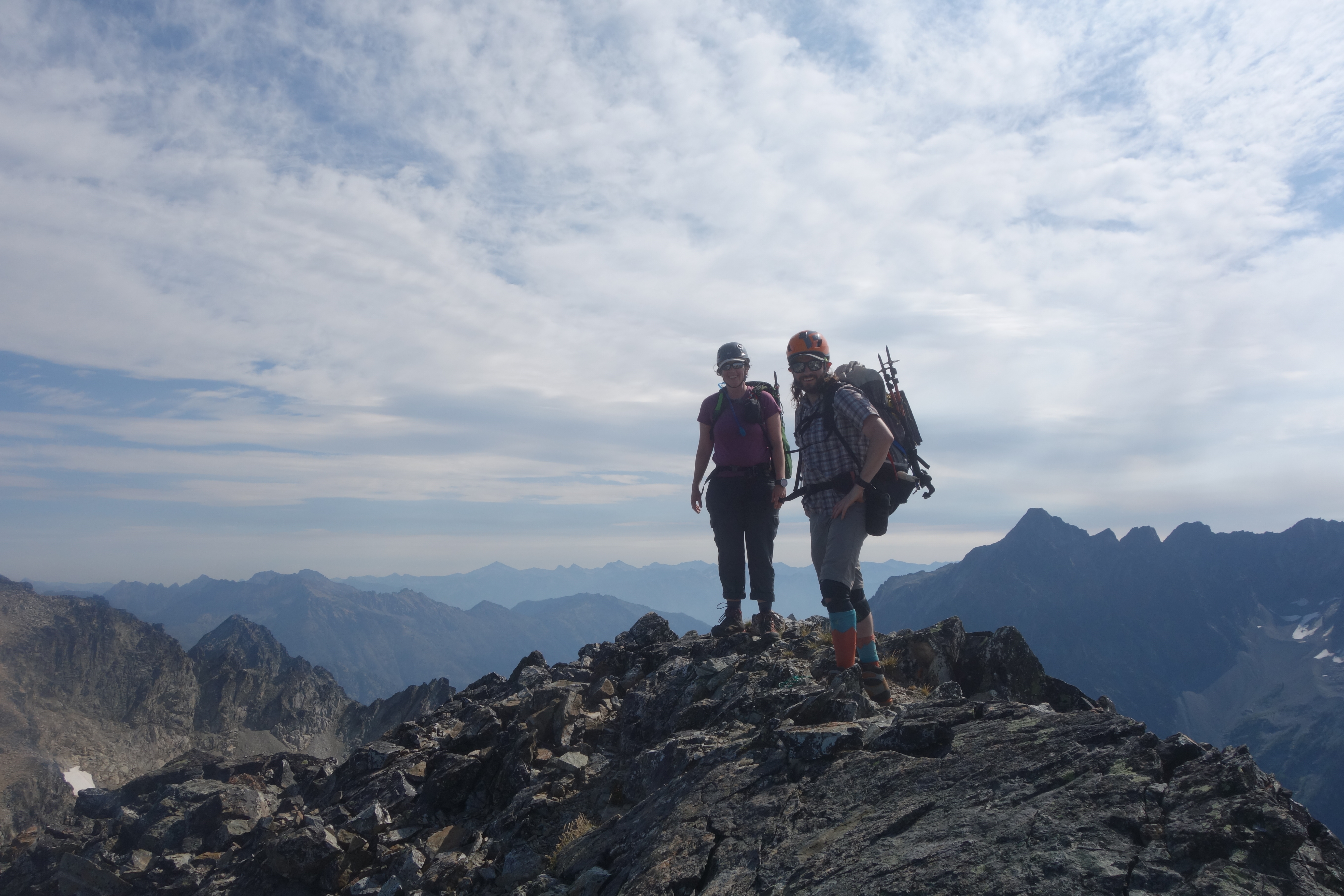
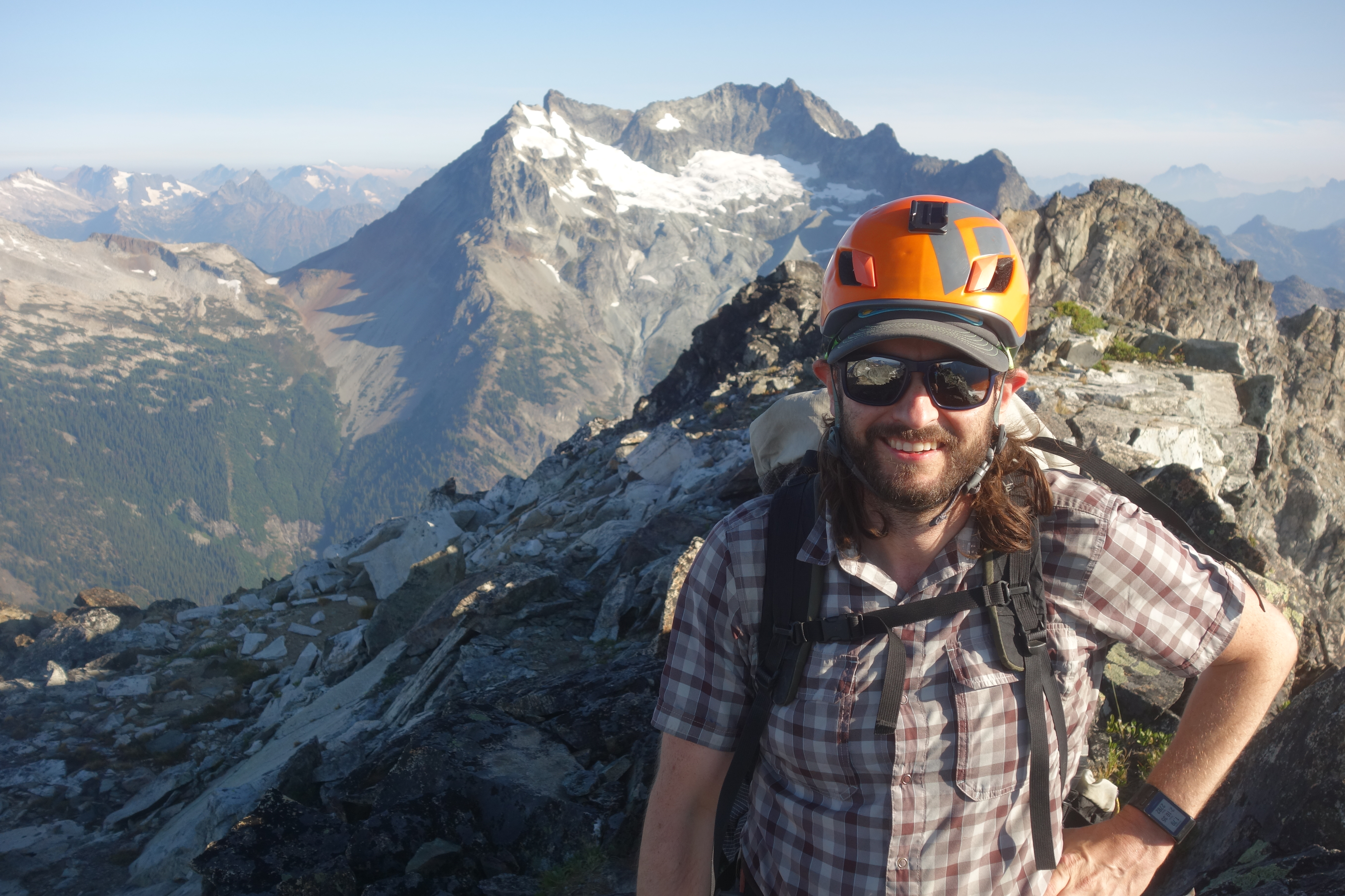 Brandon on the summit of Greenwood
 Heading back across the ledge
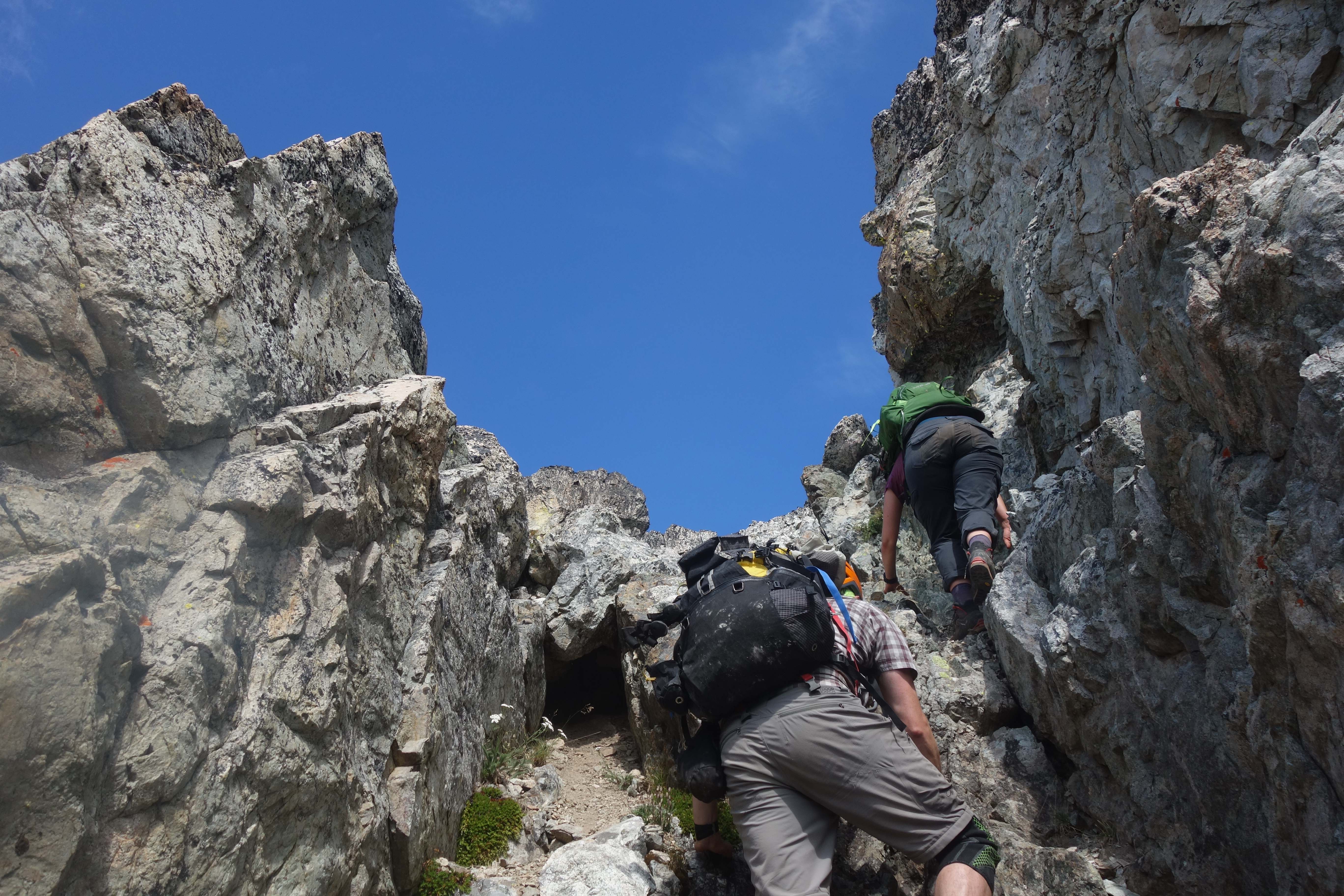
We headed back down, re-crossed the ice sheet and the ledge. Next objective was Dumbbell. We had read beta of a nice third-class chimney that would allow access to the upper mountain, and found it pretty quickly. We scrambled up through this loose gully / chimney to the southwest ridge of Dumbbell. Once on the ridge, the scrambling became pretty fun and easy, and before long we were on the top.
 Scrambling the chimney
 Brandon and Liz on the summit of Dumbbell
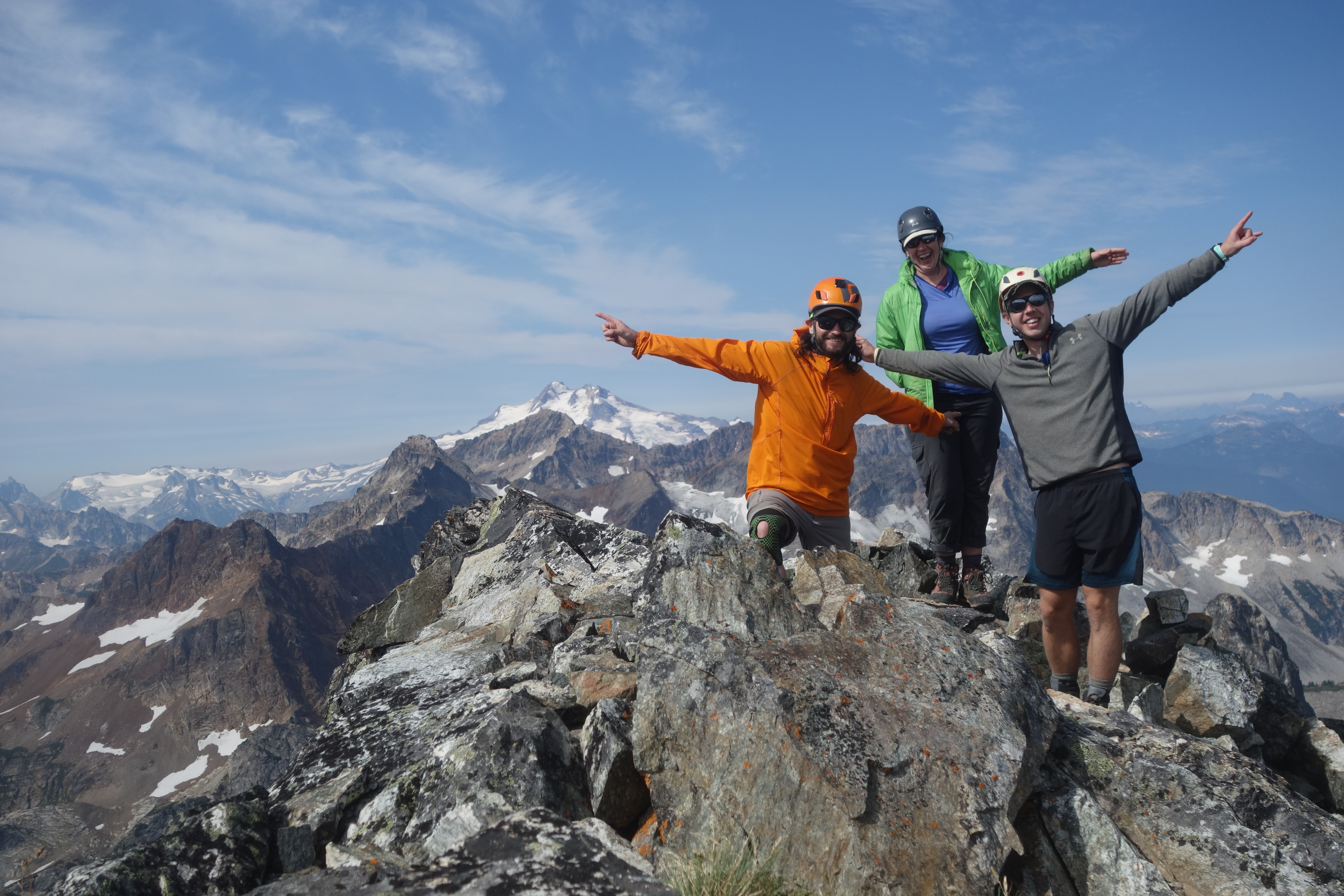 The three of us on the summit of Dumbbell
We signed the second register, and as we were writing the date (8/15) I remembered it was my mom’s birthday. I thought it would be cool to later send her a picture of me on the summit as why I couldn’t call, but Liz suggested to check the cell reception up here. Lo and behold, 4g LTE service at the top of Dumbbell! So I was able to send a picture from the summit, and receive some emails. No idea where that cell tower was though, as it’s really in the middle of nowhere (literally a wilderness).
After hanging out on the summit for a while taking in the views and playing name-that-peak, eventually we headed back down, scrambling the ridge and then the chimney. An annoying scree and talus field greeted us at the bottom of the chimney, which we made quick work of, and were soon back to camp for lunch.
 Descending the upper part of Dumbbell
We packed up and hiked out, switching mountaineering boots for trail runners in the lower basin, and were back to the cars around 5pm. A quick stop at the 59er Diner, where we saw via Google Maps that there was no HW2 traffic to speak of, and made it home before too long.
Overall this was a fun overnight, without involving anything too strenuous or stressful. Travel was quick and easy, and the views were great. I love being in this area, the Glacier Peak Wilderness, especially around August and September.